



Paliastomi Lake: Birds, Fish and Colchis Views Near Poti
Most of Paliastomi is located in the Samegrelo-Zemo Svaneti region, although its western part is part of the Guria region - Lanchkhuti municipality. The surface area of the lake is 18.2 sq. km, the basin area is 547 sq. km, maximum depth is 3 m, volume is 52 million cubic m. Among Georgian lakes Paliastomi is the third largest (after Lake Paravani and Lake Kartsakhi). Small rivers such as Pichori, Shavtkala and Tkhorina flow into the lake. The Kaparchina flows out of the lake and into the Black Sea.
Lake Paliastomi attracts tourists not only with its views and landscapes: there are places to watch migratory birds. Paliastomi together with the nearby marshes, swampy forests and the Black Sea is one of the main staging and wintering grounds of birds flying from Europe to Asia and back. Because of the increased interest in birds of prey, the abundance of migration funnels and places where the world of birds is represented in all its diversity, Lake Paliastomi is becoming more and more interesting for ecotourists and specialists.
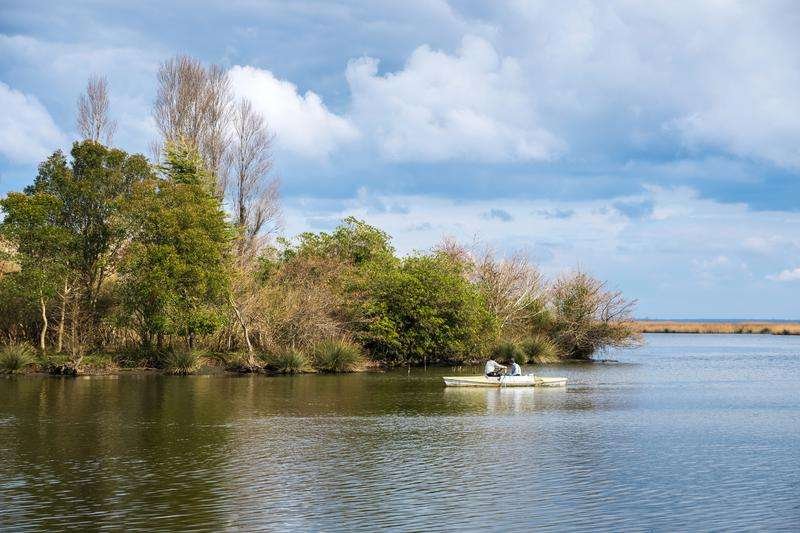
In the distant geological past Lake Paliastomi was a bay of the Black Sea. However, in the historical period, it was separated from the sea and formed into a lake. It is assumed that the rivers Rioni, Inguri, Khobi, Supsa and others flowed into the bay. The name of the lake comes from the Greek words "paleo" - old, "stoma" - mouth. Over time, the bay was gradually filled with solid particles abundantly brought by river waters and separated from the sea. At present, the lake is separated from the sea by a sandy strip of two meters.
There is a legend about Lake Paliastomi. In ancient times, on the site of the lake was dry land. It was inhabited by people who were called "Pavlias Tomi" - that is, the tribe of Paul. One day the place began to go down, the earth opened up, and from the depths water gushed out, covering the entire settlement. So the settlement of Paul's tribe" became Paliastomi Lake.
Location:
Southwestern part of Lanchkhuti Municipality; border between Samegrelo and Guria, Black Sea coast, Griki lowland; altitude — 0.3 m above sea level.
Coordinates:
42°00′54″N; 41°04′22″E (entrance to Kolkheti National Park).
How to get there:
Distance from Tbilisi (via Lanchkhuti) — 315 km, from Poti — 5 km, from Ozurgeti — 35 km, from Lanchkhuti — 33 km, from Batumi — 65 km, from Kutaisi — 90 km.

33 comments
Log in to leave a comment
Может, и не стоит искать смысл там, где его нет, просто наслаждаешься моментом и природой вокруг. Невероятно, как маленькие детали могут складываться в большую картину. Грузия, как всегда, умеет удивлять.
Особенно радуют советы от местных 👣💬 — они подсказывают, где найти самые живописные участки озера, какие дорожки ведут к любимым точкам для фото 📸 и какие моменты стоит обязательно увидеть, чтобы почувствовать атмосферу этого места полностью 🌿💛
После спокойной прогулки у воды так приятно представить, как ты зайдёшь в уютное кафе ☕🍰, обсудишь впечатления с друзьями за чашкой ароматного кофе и бокалом грузинского вина 🍷 — такой отдых на свежем воздухе остаётся в сердце надолго! 🌞🌍
Мне очень нравится, как этот рейтинг помогает прочувствовать дух Палиастоми ещё до поездки: живые описания, отзывы путешественников и полезные лайфхаки делают путешествие настоящим удовольствием 🌿💫
А вы уже были у озера Палиастоми? Какие виды или уголки вокруг него вас впечатлили больше всего, и в какое время года, по вашему мнению, сюда стоит отправляться, чтобы увидеть всё особенно красиво? 🌿📸💙