




🗺️ Georgia's Most Dangerous Road: a Driver's Guide to the Abano Pass in Tusheti
🗺️ What to Know About Abano Pass
The highest drivable pass in the Caucasus at 2,826 metres and the only road into Tusheti. An unpaved mountain track with no guardrails over sheer drops, open only in summer. In winter the region is accessible by helicopter only.
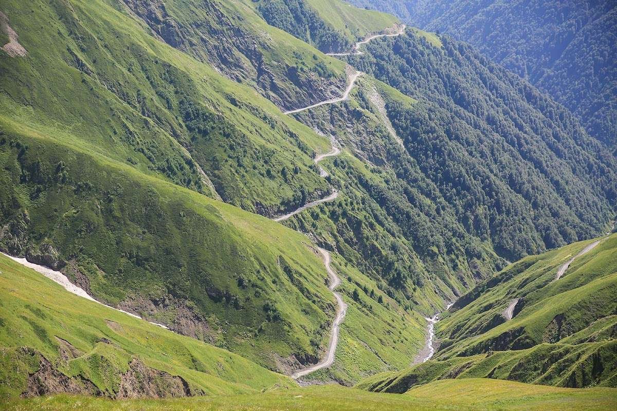
Abano Pass lies in the central Greater Caucasus, on the boundary between Kakheti and Tusheti, at 2,826 metres above sea level. Through it runs the only road connecting Tusheti to the rest of Georgia. There is no alternative: either 67 kilometres of dirt track over the pass, or a helicopter. For everyone heading to Omalo and the Tushetian villages, the pass is not an attraction — it is a mandatory section of the journey.
The road has a difficult reputation. It appeared in a BBC programme about the world's most dangerous roads, and in 2013 was included in a list of the most extreme roads in Europe. And yet, every summer, thousands of people drive it without incident: shepherds move their flocks, locals carry supplies, tourists make their way to Tusheti National Park. The danger comes not from the road itself but from the wrong vehicle, an inexperienced driver or bad weather. Get those three things right, and the Abano Pass becomes one of the most spectacular drives in Georgia.
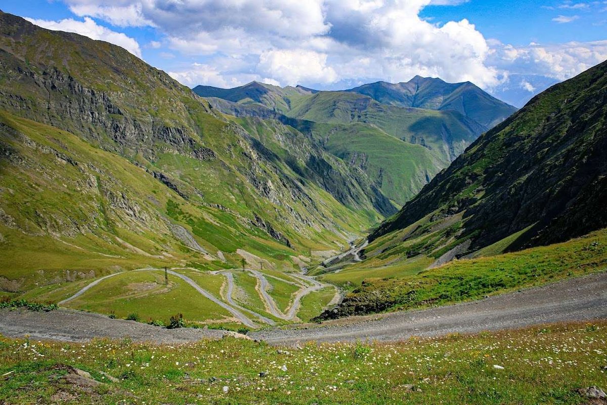
🗺️ The Road Over Abano Pass
Open in Google Maps🏔️ What Is Abano Pass: Facts and Figures
Abano Pass sits on the watershed between Kakheti and Tusheti, close to the Russian border. Its elevation is 2,826 metres, making it the highest drivable pass in the entire Caucasus. A second name appears in some sources: Torgva Pass.
The road through the pass carries official status and the designation M44. It was built in 1978, during the Soviet period, and has remained unpaved along its full length ever since. From the village of Pshaveli in Kakheti, where the dirt begins, to Omalo in Tusheti, the distance is approximately 67–72 kilometres. In good weather that stretch takes 3–5 hours, since speeds rarely exceed 20–30 km/h.
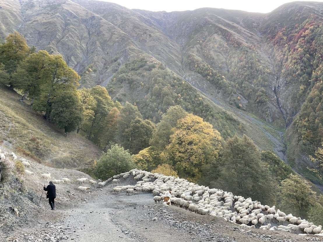
This is not simply a scenic drive: it is a working supply route. Shepherds use it to move their flocks, local families carry in provisions, and tourists arrive every summer. Each spring, thousands of sheep and cattle walk the same route on foot to the highland pastures of Tusheti. The road requires constant maintenance: landslides regularly block it, and crews clear debris throughout the season. Among the mountain roads of Georgia, Abano stands apart as the most demanding, which is clear from any comparison with the other mountain passes of Georgia.
🌀 What the Road Looks Like: Switchbacks, Drops and Landslides
The road breaks into several distinct sections, and understanding their sequence makes the drive considerably less intimidating.
From Pshaveli the track follows the river gorge through forest, gaining elevation slowly. This is the calmest section: rough, but not frightening. Then the switchbacks begin. The first demanding section consists of several tight hairpin turns climbing from around 1,600 metres to 2,100. Some corners are so tight that a large 4WD needs to reverse to make the turn.
Above the switchbacks the road narrows further and runs along an open mountainside. This is the section that appears in photographs: a narrow shelf with a rock wall on one side and an unguarded drop on the other. In several places waterfalls cross the road surface, turning it to mud and reducing visibility. A second set of switchbacks then leads to the pass summit at 2,826 metres. After the summit the hardest part is behind you; the descent into Tusheti is less exposed, though the road remains rough and slow.
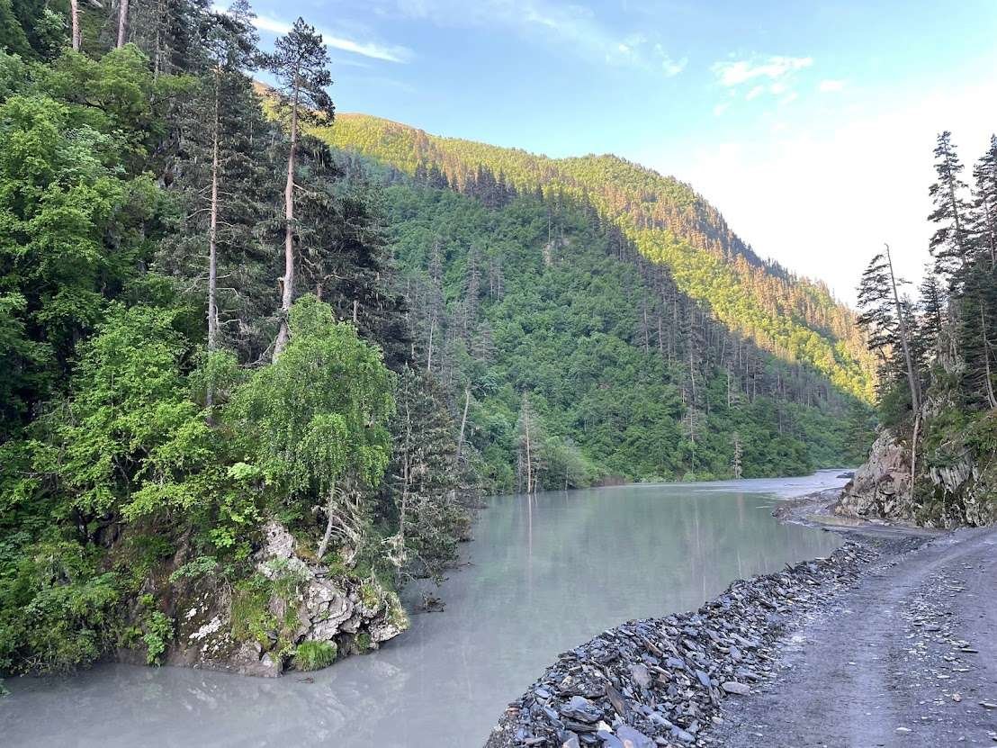
The most problematic stretch is the landslide zone near Zobeni, at the 50th and 53rd kilometres. Ground here can move for hours, and these sections close the road most often. Memorial crosses stand along the roadside at spots where vehicles went over the edge. They mark real people.
📅 When the Pass Is Open and When to Go
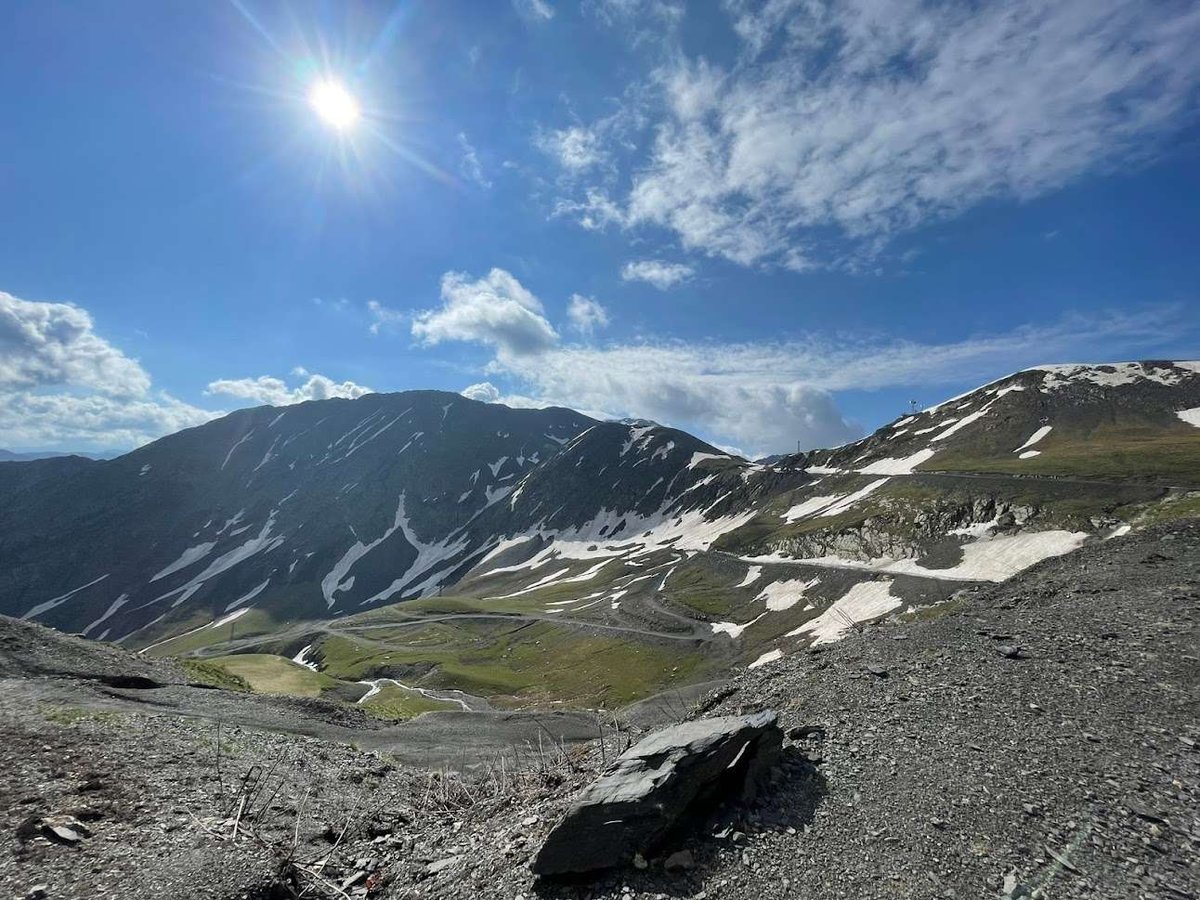
The pass operates for only a few months each year. It typically opens in late May or early June and closes in October, with exact dates depending on how quickly the spring snow melts and when autumn snowfall begins. Through the entire winter the road is impassable, and Tusheti can be reached only by helicopter.
The best window for travel is June through September, when weather is most stable. July and August are peak season: the road is in its most reliable condition, guesthouses in Tusheti are open and the Tushetoba festival takes place. The edges of the season carry more risk. In early June snow may still lie on the pass; in October the weather changes sharply and without warning.
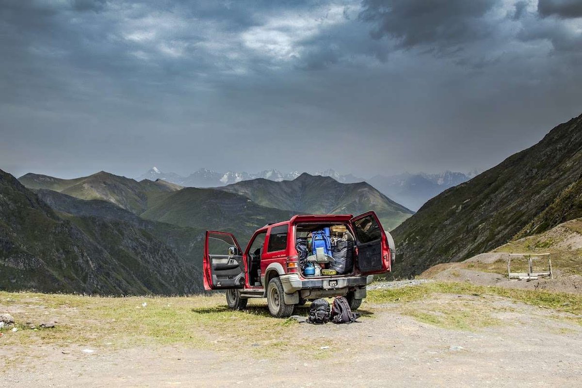
Check road conditions separately before travelling: landslides can close the pass for days even in midsummer. Guesthouses in Omalo and local drivers in Alvani and Telavi know the current situation.
Only 4x4 vehicles are allowed over Abano, and most rental companies require written permission for this route. Ask before you book.
Need a 4x4?
Local companies rent Pajero, Delica and Prado with full cover. Compare prices and availability for your dates.
Affiliate link: we may earn a commission, your price stays the same.
🚗 Driver's Guide: How to Make the Drive Safely
The first decision is whether to drive independently or hire a local driver. Independent driving is possible, but only with a proper 4WD, genuine mountain driving experience and steady nerves. Without those, hiring a local driver is the sensible choice. Guesthouses in Omalo typically arrange transfers from Alvani or Telavi. They have long-standing relationships with reliable drivers, and their reputation depends on sending someone trustworthy.
🚙 Four Conditions for a Safe Drive
On the road itself, drivers frequently stop before blind corners to check for oncoming traffic: passing on a narrow shelf is sometimes impossible, and one vehicle has to reverse to a wider section. This is standard practice, not a sign of trouble. Rushing is more dangerous than anything else on this road.
⛪ At the Summit: Chapel, Crosses and a Café Above the Clouds
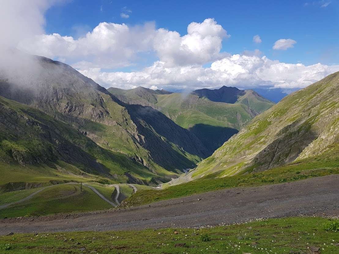
The summit of the pass is not just the highest point of the drive — it is where almost everyone stops. A small chapel stands here, and memorial crosses line the approach. A little temporary café sometimes operates at the top, called 'Above the Clouds'. The name is accurate: cloud cover often sits below the pass, and from above you look out over a white sea of cloud.
A stop at the summit is part of almost every itinerary. People photograph, catch their breath after the hardest part of the climb and simply stand, taking in the altitude. In good weather the views rank among the finest in the Caucasus: ridges run to the horizon in every direction, and below you can trace the line of the road you have just driven up.
🏔️ What Comes Next: Tusheti
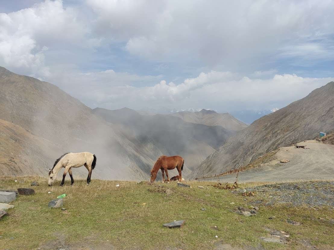
After the descent the road follows a river, the surface calms and the valley opens up. The main village of Tusheti, Omalo, sits at around 1,850 metres. This is what the drive is for: medieval stone towers, alpine meadows, shepherds moving thousand-head flocks and villages that have changed very little over the centuries.
The nature, flora and fauna of the protected area covering almost all of Tusheti are described in Tusheti National Park. The Akhmeta district, where the road to the pass begins, holds another reserve worth combining with the trip: Ilto National Park with its pristine beech forests in the upper river valley.
📌 Pre-Drive Checklist
Have you driven the Abano Pass? Leave a review: tell us whether you went independently or with a local driver, what month it was, what the weather was like and which section felt the most demanding. Your experience helps those who are still planning the trip.
Information is current as of June 2026. Pass opening dates, road conditions and landslide closures change from year to year. Check current conditions with Omalo guesthouses or local drivers in Alvani before setting out.
❓ Frequently asked questions
💬 Abano Pass is a high mountain pass in the Greater Caucasus on the boundary between Kakheti and Tusheti, at 2,826 metres above sea level. It carries the only road into Tusheti and is the highest drivable pass in the Caucasus. A second name appears in some sources: Torgva Pass.
💬 Typically from late May or early June through October, with exact dates depending on snowmelt in spring and the first autumn snowfall. In winter the road is completely impassable and Tusheti is accessible only by helicopter. The most reliable window is June through September.
💬 No. The road is unpaved, with river crossings, steep switchbacks and badly broken sections. A 4WD with high clearance is required. A standard car will not make it. If you do not have a suitable vehicle, hire a local driver through a guesthouse in Omalo.
💬 It has appeared on lists of the world's most dangerous roads and in a BBC programme. The main risks are guardrail-free switchbacks over sheer drops, the landslide zone at Zobeni and rapid weather changes. With the right vehicle, an experienced driver and clear weather, the road is drivable — thousands cross it every summer. But it demands respect.
💬 The unpaved section from Pshaveli to Omalo, 67–72 kilometres, takes 3–5 hours in good conditions. Speeds rarely exceed 20–30 km/h. From Tbilisi to the start of the dirt at Pshaveli is another 120–130 kilometres of paved road.
💬 No. There are no fuel stations in Tusheti at all. The last opportunity to fill up is in Alvani or Pshaveli before the climb. Carry enough for the round trip.
💬 Wait it out. Fog and rain on the exposed sections without guardrails make the road genuinely dangerous: visibility drops and the surface becomes slippery. Set off in the morning to cross before conditions can deteriorate in the afternoon.
💬 By helicopter only. The road is completely blocked by snow through the winter. The authorities run seasonal helicopter flights, but these are frequently cancelled due to weather. Most local residents leave Tusheti for the winter months.
💬 The main village Omalo with its medieval Keselo towers in the old quarter. Beyond Omalo: alpine meadows, ancient stone tower villages, hiking routes through Tusheti National Park and the summer Tushetoba festival.

5 comments
Log in to leave a comment