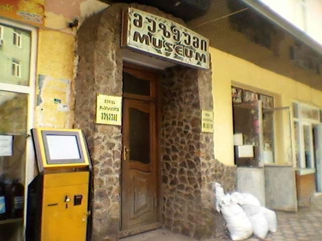
Add organization

    Keda

    📍Location: Adjara, Acharsistskali River valley; approx. 42 km east of Batumi; Sh1 Batumi — Akhaltsikhe highway
    👥Population (municipality): ≈14,500 (estimate 2024)
    👥Population (city): 1,285 (2021)
    🏛️City status: (daba — urban-type settlement)
    📏Area (municipality): 452 km²
    ⛰️Elevation (center): 256 m
    🗣️Official language: Georgian (local Adjarian dialect)
    Time zone: GET (UTC +4, no daylight saving time)
    💰Currency: Georgian lari (GEL)
    🍇Wine region: center of Adjarian winemaking (Chkhaveri, Tsolikauri; tastings in family marani)
    🏞️Attractions: Makhuntseti Waterfall, medieval arched bridges (Dandalo, “Queen Tamar Bridge”)

    Where to eat in Keda

    ❓ Questions and Answers

    What is the distance to Keda from Batumi?

    The distance from Keda to Batumi is 26 kilometers in a straight line, 41.5 kilometers along the pedestrian route, 41.7 kilometers along the highway.

    What is the distance to Keda from Tbilisi?

    The distance from Keda to Tbilisi is 238 kilometers in a straight line, 337.1 kilometers along the pedestrian route, 331.9 kilometers along the highway.

    Where is Keda?

    Keda is located in Adjara, in an urban village, which is the center of the Keda municipality. It is located on the Adjaristskali River, which is a tributary of the Chorokhi River. Keda is located 41 km east of Batumi.