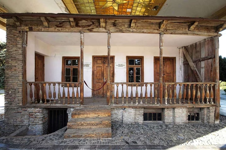
Historical and Ethnographic Museum in Gori
The expositions of the historical and ethnographic museum contain unique objects found during archaeological excavation…


The distance from Gori to Batumi is 208.0 kilometers in a straight line, 280.6 kilometers along the pedestrian route, 279.8 kilometers along the highway.
The distance from Gori to Tbilisi is 66.0 kilometers in a straight line, 111.0 kilometers along the pedestrian route, 87.0 kilometers along the highway.
Gori is located in eastern Georgia, in the center of the Shida Kartli region. The city is located in the Kartli Valley, where the Kura River and its tributary Big Liakhvi meet. It is surrounded by mountains to the south and west. Gori is located 77 km northwest of Tbilisi and 32 km south of Tskhinvali.